Quick Links
Calendar
| | Sun | Mon | Tue | Wed | Thu | Fri | Sat
|
Categories
Archives
XML/RSS Feed
Statistics
Total entries in this blog:
Total entries in this category:
Published On: Jul 26, 2007 10:47 PM
|
The Peramangk
The Peramangk were the mysterious dwellers of the
Mount Lofty Ranges prior to the white occupation of South Australia in 1836.
Twenty years after the Mount Barker region was settled, they had
disappeared.
It is difficult to make an accurate assessment of
the original number of Aboriginal occupants who dwelt in what we now call the
Mount Lofty Ranges. For example, two separate estimates of the numbers of
Kaurna on the Adelaide Plains at settlement, suggest as few as three hundred,
and as many as seven hundred when the colonists arrived in 1836. Obviously it
would be more difficult, given the many forests and a more rugged terrain in the
hills, to make an accurate assessment of the Peramangk numbers.
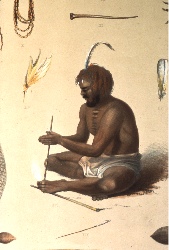
 Peramangk
ManA further complication was the
spread of smallpox, even before South Australia was formally settled in 1836.
Having established a foothold in the colony of NSW in 1789, smallpox gradually
worked its way into southern Australia, possibly via whalers and sealers who
used Kangaroo Island as a base as early as 1810. Smallpox is also said to have
come down the major river, which we now know as the Murray, perhaps through
native people who had come into contact with smallpox when upstream, and had
brought it south. The traditional numbers were therefore depleted before
settlement, and it is unlikely any serious attempt was made to obtain accurate
numbers in a new, rugged land, where survival alone was quite enough to cope
with. Having no genetic resistance to smallpox, the impact on the traditional
inhabitants was deadly, as were diseases of lesser concern to Europeans, such as
measles. An early account of the
Peramangk people puts the greater number of them in the Mount Barker region, and
they were often referred to as the 'Mount Barker Tribe.' One description tells
of somewhere near 300 camped at the base of Mount Barker Summit, and another 300
camped along the Larataringa Creek and the springs to the south of the mount. It
would seem a reasonable guess to put a figure of around seven hundred to a
thousand Peramangk in the region considered their domain, based on these
estimates. One must also bear in mind that gatherings of this number would be
rare, and would undoubtedly have been the result of important ceremonial
occasions. Initiation, 'increase' ceremonies to ensure the abundance of food and
the cycle of the seasons, 'sorry' business, (funeral rites) and the practice of
allocating future wives to young men, are but a few of the ceremonies practised
throughout the vast territories of Australia, and in the remote regions, still
undertaken to this very day. In 'normal' times, groups of up to perhaps thirty,
comprised of an elder, his wives, and his offspring, including in-laws, would
roam the land, according to where the appropriate food, shelter or water was to
be found.
Peramangk
ManA further complication was the
spread of smallpox, even before South Australia was formally settled in 1836.
Having established a foothold in the colony of NSW in 1789, smallpox gradually
worked its way into southern Australia, possibly via whalers and sealers who
used Kangaroo Island as a base as early as 1810. Smallpox is also said to have
come down the major river, which we now know as the Murray, perhaps through
native people who had come into contact with smallpox when upstream, and had
brought it south. The traditional numbers were therefore depleted before
settlement, and it is unlikely any serious attempt was made to obtain accurate
numbers in a new, rugged land, where survival alone was quite enough to cope
with. Having no genetic resistance to smallpox, the impact on the traditional
inhabitants was deadly, as were diseases of lesser concern to Europeans, such as
measles. An early account of the
Peramangk people puts the greater number of them in the Mount Barker region, and
they were often referred to as the 'Mount Barker Tribe.' One description tells
of somewhere near 300 camped at the base of Mount Barker Summit, and another 300
camped along the Larataringa Creek and the springs to the south of the mount. It
would seem a reasonable guess to put a figure of around seven hundred to a
thousand Peramangk in the region considered their domain, based on these
estimates. One must also bear in mind that gatherings of this number would be
rare, and would undoubtedly have been the result of important ceremonial
occasions. Initiation, 'increase' ceremonies to ensure the abundance of food and
the cycle of the seasons, 'sorry' business, (funeral rites) and the practice of
allocating future wives to young men, are but a few of the ceremonies practised
throughout the vast territories of Australia, and in the remote regions, still
undertaken to this very day. In 'normal' times, groups of up to perhaps thirty,
comprised of an elder, his wives, and his offspring, including in-laws, would
roam the land, according to where the appropriate food, shelter or water was to
be found.
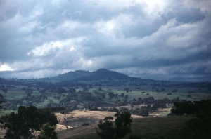
 Mt Barker Summit (Womma Mu Kurta - The
Mountain on the Plain)Despite the
reference to the Peramangk as the 'Mount Barker Tribe' their terrain was much
more wide - ranging, and in general their territory was considered to be the
region we now refer to as the Mount Lofty Ranges, extending from the foothills
above the Adelaide plains, Mount Barker to the east, Myponga to the south, and
northward to Angaston. Both the Kaurna of the plains, and the Ngerringerri of
the lakes and southern river regions feared the Peramangk, who were said to be
possessed of magical powers and sorcery.
Prior to colinisation, there were
three explorations of South Australia directly relevant to the fate of the
Peramangk, and following articles will provide an account of those expeditions.
Particular attention will be paid to early and first contact by these
expeditions as an insight into attitudes and consequences of relationship to the
indigenous peoples in general, as there is little documentation of first contact
specifically with the Peramangk.
Mathew FlindersCaptain
Matthew Flinders of the
Investigator
in 1802, and coincidentally Captain Nicholas Baudin on the
Geographe
the same year, commanded the first expeditions to undertake comprehensive
exploration of the southern coast. Baudin's explorations were predominately of a
scientific nature, with a full compliment of botanists, artists, and other
scientific people on board. He naturally created charts and named places as he
went. Flinder's brief was to circumnavigate the continent, mapping
comprehensively, and therefore the documentation of his journey was skewed to
this end. When western bound Flinders, (an Englishman) and the eastern sailing
Frenchman Baudin met in the bay they called Encounter in April of that year,
they exchanged charts and wined and dined together, although unbeknown to them,
their countries were at war. They also in part accepted the place names each had
given the coast during their travels, thus explaining the mixture of French and
English names which dot the coast. The Fleurieu Peninsula is a prominent example
of features named by Baudin. The Flinder's Ranges, Kangaroo Island and Mount
Lofty are among the most prominent and well known English names which Flinders
conferred on the landscape.
 Encounter
BayIncredibly, both of these renowned
explorers missed the mouth of Australia's most important river, not far from
their historic meeting. In their defence, the Murray meets the ocean via a
large lake before meandering around islands in diverse channels, and a long
narrow body of water stretches some eighty kilometres to the south-east,
sheltered from the ocean by large sand dunes. This body of water is called the
Coorong. Sand dunes on both sides of the modest volume of water which
constitutes the Murray mouth, as well as a possible sea mist, coupled with the
distance from the shore at which the ships would have been sailing, would all
have contributed to the oversight by both
Commanders.Some of the earliest
sketches of Aboriginal people can be found in Baudin's collection, and his
party's contact with Aboriginal people was comprehensive, although not so much
in South Australia, where the rugged coastline made anchoring difficult. It was
established that Kangaroo Island was devoid of Aboriginal people, although
subsequent archaeological work has established that it had previously been
inhabited approximately 10,000 years ago, when the island was still part of the
mainland. No reliable explanation has been proffered as to why such a large and
productive island did not have people in numbers living there at the time of
settlement. There were, however, a rag-tag band of sealers of various
nationality, including Americans, escaped convicts, and the Aboriginal women
they had gathered from where ever they could. This included Tasmanian women, and
also women from the mainland. These women were taken by force, resulting in a
tragic retaliation in later years. This motley crew would have been living on
Kangaroo Island when the next important exploration of Southern Australia took
place in 1829-30, although Captain Charles Sturt was probably unaware of their
presence. For some detail of Sturt's journey, click here.
A little over a year later, the tragic death of Captain
Collet Barker at the mouth of the Murray River added a tragic chapter
to Aboriginal/European first contact.
Posted: Thu - September 21, 2006 at 04:14 PM
|
